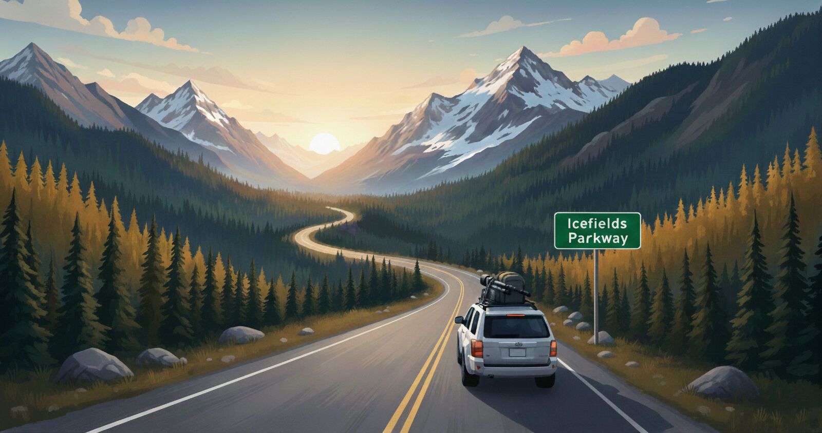
Icefields Parkway Photography Guide: 25 Best Photo Locations
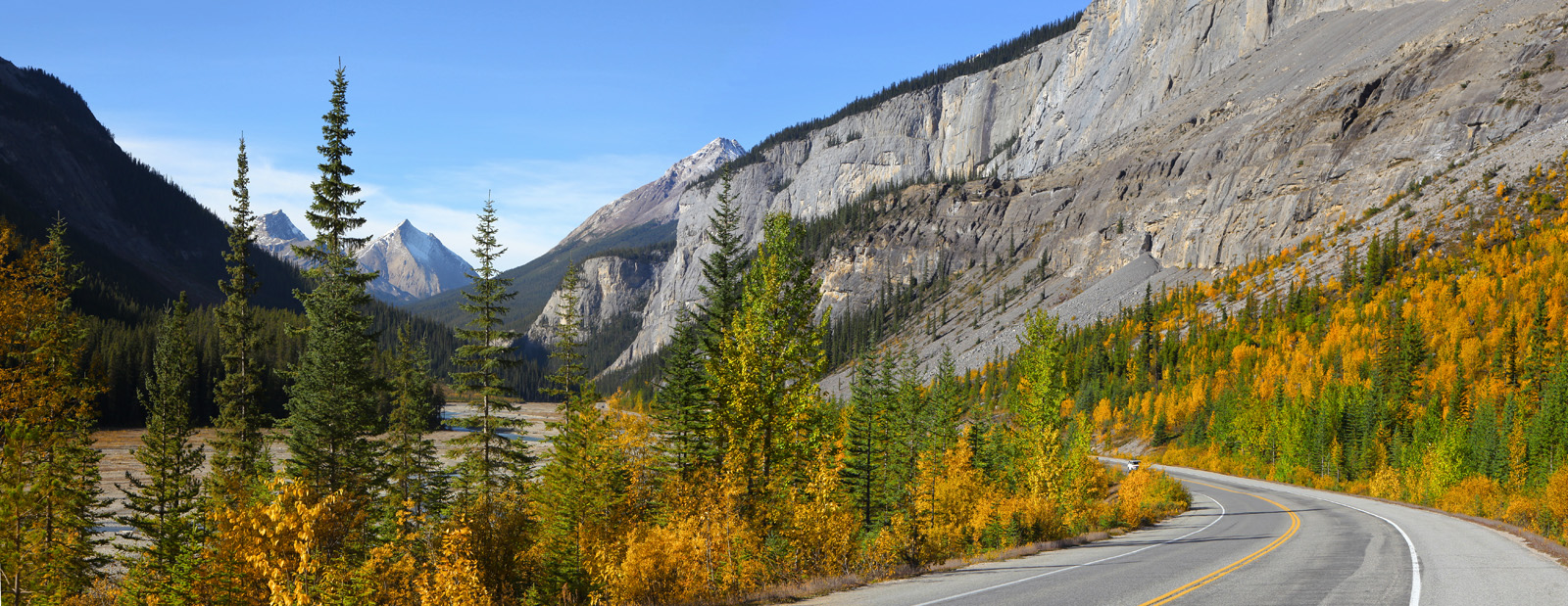
Stretching 232 kilometers from Lake Louise to Jasper, Alberta, the Icefields Parkway is one of the world’s most scenic drives. For landscape photographers, it’s a visual masterpiece — a corridor of turquoise lakes, glaciers, waterfalls, and towering peaks.

This Icefields Parkway photography guide will help you plan your route, choose the best times to shoot, and photograph the Canadian Rockies with intention — from Lake Louise to Jasper.
About This Guide
All recommendations in this guide are based on years of photographing the Icefields Parkway in different seasons and lighting conditions.

Many of the images featured in this guide are available as limited-edition fine art prints, and several locations have been photographed repeatedly over the years to refine timing, composition, and seasonal conditions.
What This Guide Covers
- 25 of the best photography locations along the Icefields Parkway, with reference photographs
- Interactive photo location map
- Things to know before you go, and gear recommendations
- Exact driving distances from Lake Louise, Jasper, and Saskatchewan Crossing
- Best light and seasonal recommendations for each stop
- Optional side trip to Abraham Lake and Crescent Falls
- A downloadable PDF version of this guide for trip planning
And remember, if you truly want the best light for your images, you can't do the entire parkway in a day. Plan ahead for your favourite season, and camp or lodge along the way for the most immersive experience.
Interactive Photo Location Map
Use my custom interactive map below to explore all 25 landscape photography locations along the route. Each pin marks a carefully selected photo spot, and includes all of the key details and practical tips from my experience photographing these areas.
Click the white rectangle at the top left to view all layers and location listings. Zoom in and tap or click any location to see reference photos, details, and toggle layers to plan your route and shooting schedule efficiently.
To see a large version of the map, click the white square expansion symbol on the top right to open in a new tab on your computer.
Things To Know Before You Go
The Icefields Parkway is located within two National Parks, Banff and Jasper, where an admission pass is required. The best option would be the annual Discovery Pass which can be purchased online or at one of the park gates. There are two seasonal gates on the Parkway itself, as well as Banff and Jasper east gates, all shown on the interactive map above. A Parks Canada webpage with gate location details can be found here.
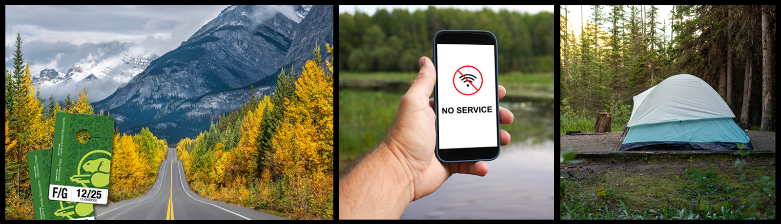
There is no cell service on the Parkway, and you can expect to lose your signal not long after leaving the Lake Louise or Jasper townsites. The exception is service at the Columbia Icefield Discovery Centre, but only from May to early October.
Accommodations are available June through September with eleven seasonal campgrounds for RVs and tents, five wilderness hostels, and a few hotel options. This Parks Canada webpage has relevant informational links. Most hotels require advance booking; most campgrounds are first-come-first-served. Check ahead of time.
Winter travel is mostly limited to day trips, with all services closed mid-October to April. Ensure your vehicle is fueled, equipped with winter tires or chains, and check Parks Canada road reports before heading out.
Road closures are common due to controlled/uncontrolled avalanche conditions, although they don't usually last more than a day or two. Visit this Parks Canada webpage for detailed information on winter travel on the Parkway.
FREE DOWNLOAD: ICEFIELDS PARKWAY PHOTOGRAPHY GUIDE (PDF)
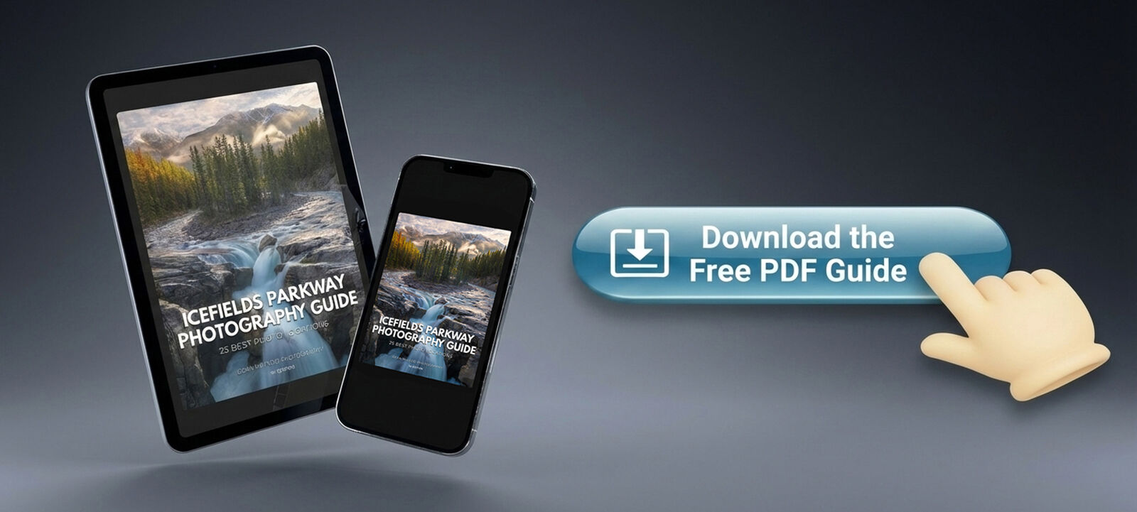
Prefer something you can save or print? Click the Button above for the free downloadable Icefields Parkway photography map and PDF version of this guide — with all locations, distances, and best-light notes.
- No signup required
- 43 page full colour PDF
- With no cell service on the Parkway, this PDF can be saved to your device so you never miss a shot
25 Best Icefields Parkway Photo Locations
South to North: Lake Louise → Jasper
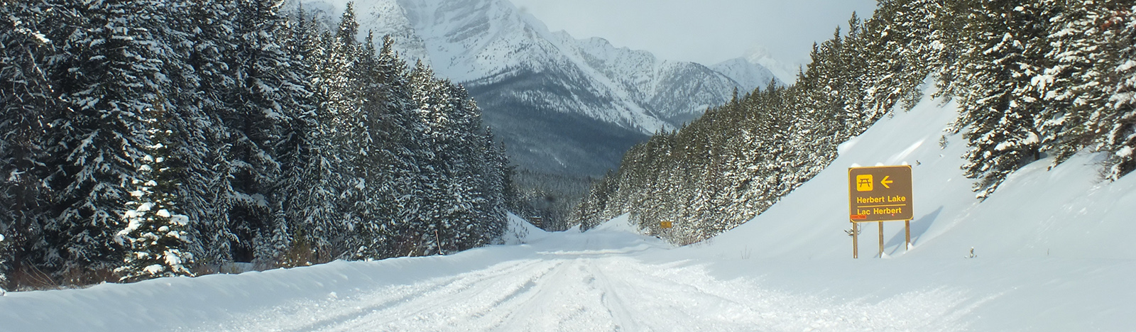
1. Herbert Lake
Distance: 6 kms from Lake Louise | 226 kms from Jasper | 73 kms from SK Crossing
Best Light: Sunrise, calm mornings
Best Time of Year: July to October
A classic reflection lake with grand peaks from Mount Temple to Mount Niblock rising behind it. Early mornings often deliver glassy water and misty alpine atmosphere — one of the best sunrise stops near Lake Louise.
Park in the main lot and stroll down to the lakeshore. Picnic tables and washrooms are available.
2. Crowfoot Glacier Viewpoint
Distance: 36 kms from Lake Louise | 196 kms from Jasper | 43 kms from SK Crossing
Best Light: Sunrise, morning
Best Time of Year: July to September
A roadside pull-out offering an expansive view of Crowfoot Mountain and Glacier. Ideal for telephoto compositions isolating ice, rock, and texture.
For a closer view, backtrack and park at the small pull-out one kilometre before (southeast of) the main viewpoint. Walk down through the trees across a grassy incline to the water's edge. Waterproof boots are useful here.
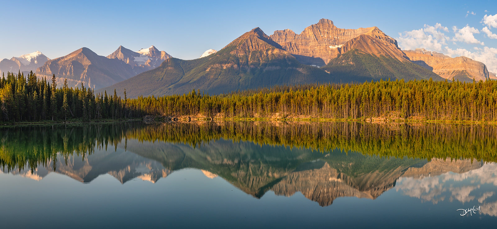
3. Bow Lake
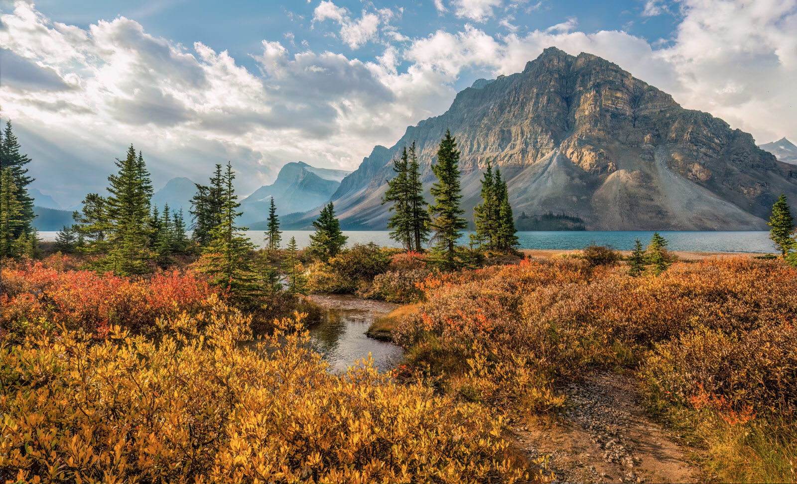
Distance: 38 kms from Lake Louise | 194 kms from Jasper | 41 kms from SK Crossing
Best Light: Sunrise
Best Time of Year: Mid June to early August for wildflowers; fall foliage from mid September to early October. Winter for untouched snow and hoarfrost.
One of the most beautiful lakes in Banff National Park. Wide-angle views with an expansive shoreline full of foreground interest and leading lines make this a must-shoot location in any season. Winter provides unique opportunities with deep mounds of snow and hoar frost. Snowshoes recommended.
Bathrooms in the parking lot. Hanging Glacier Cafe is open late May to early October for lunch, coffee, and baked goods.
4. Peyto Lake (Bow Summit) | Highest Point on the Parkway
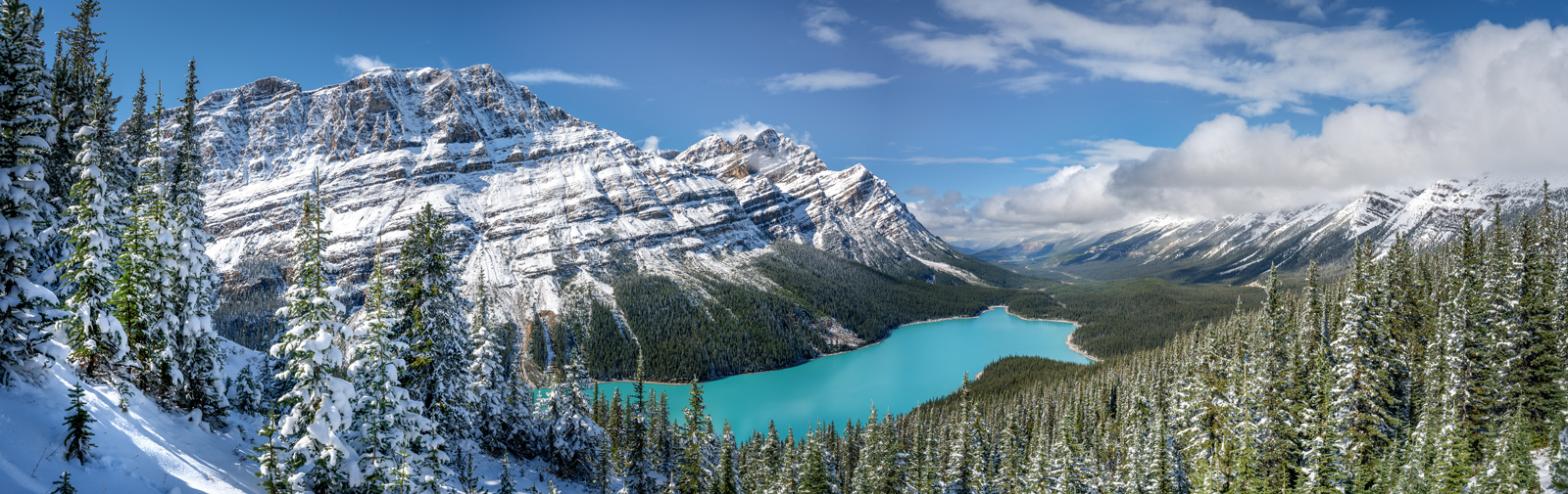
Distance: 43 kms from Lake Louise | 189 kms from Jasper | 36 kms from SK Crossing
Best Light: Late morning to early afternoon
Best Time of Year: July to October
Famous for its unmistakable wolf-shaped form and electric turquoise colour, Peyto Lake is best photographed when the sun is high enough to illuminate the water fully for maximum colour.
A short drive on the access road takes you to the parking area on the right (the road does continue uphill here, but ends at a drop-off area for mobility-challenged visitors; no parking). From the main parking lot a non-strenuous, ten minute walk on a paved trail takes you uphill to the main viewpoint.
For further exploration from the main viewpoint, you can follow the trails to the south towards Bow Summit for additional vantage points. The trail eventually crosses over to the east side of the mountain for elevated views of the Parkway and Bow Lake to the southeast. Bathrooms in the parking lot.
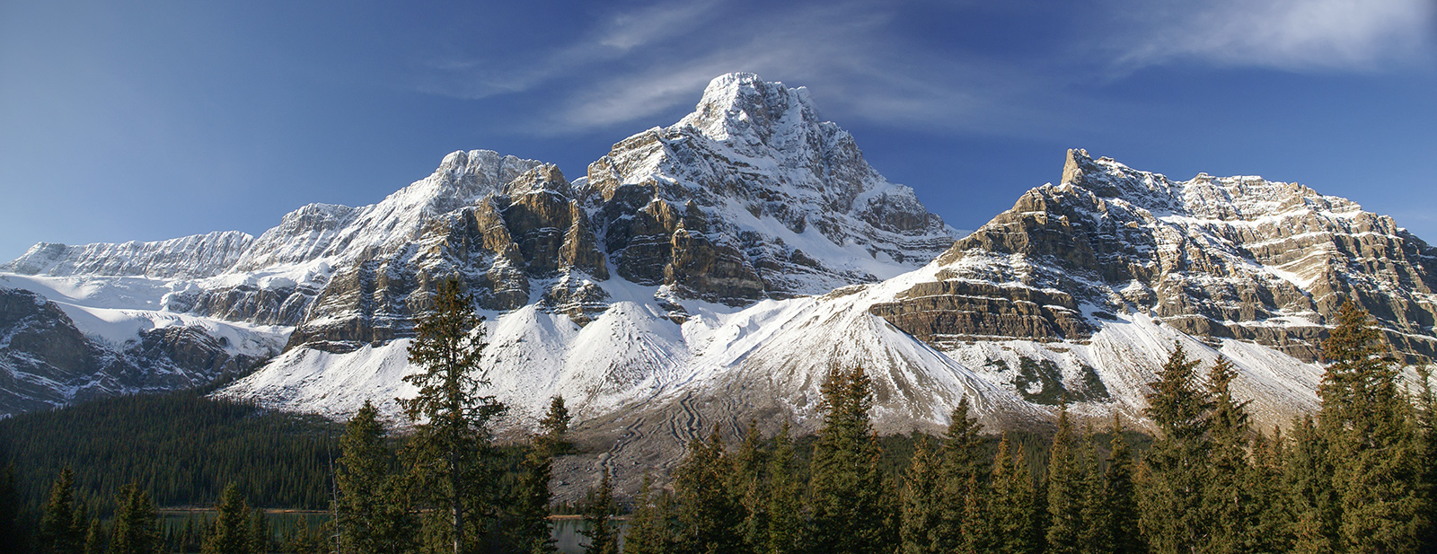
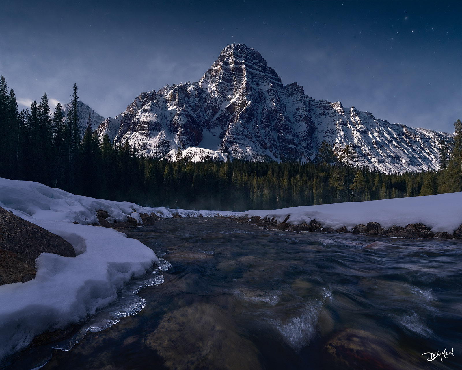
5. Waterfowl Lakes Viewpoint | Mount Chephren
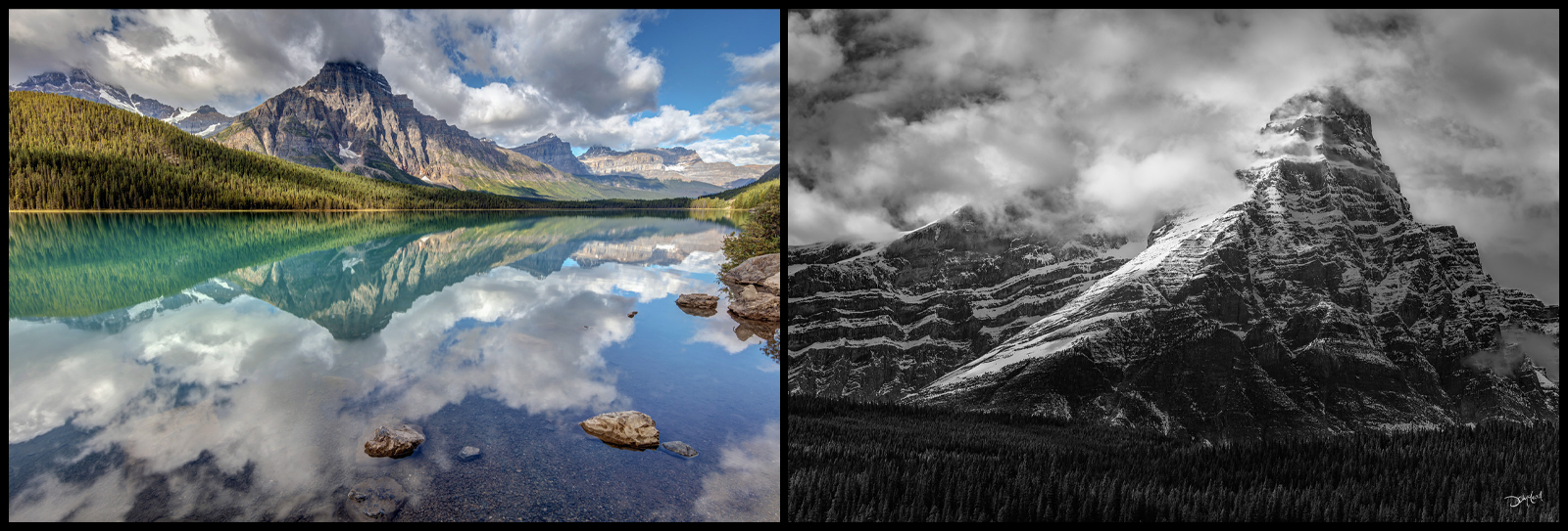
Distance: 61 kms from Lake Louise | 171 kms from Jasper | 18 kms from SK Crossing
Best Light: Sunrise or sunset
Best Time of Year: February to early May for winter scenes with easy-to-traverse open/low water levels directly below Mount Chephren; July to early October for reflections and atmosphere.
Twin lakes framed by rugged peaks and wetlands. Excellent foreground possibilities and dramatic skies.
At the end of the north lake, there is another small pull-out. Parking here and walking down through the trees along the lakeshore gives a closer perspective of the mighty Mount Chephren looming above the river, a perfect location for open-water winter compositions.
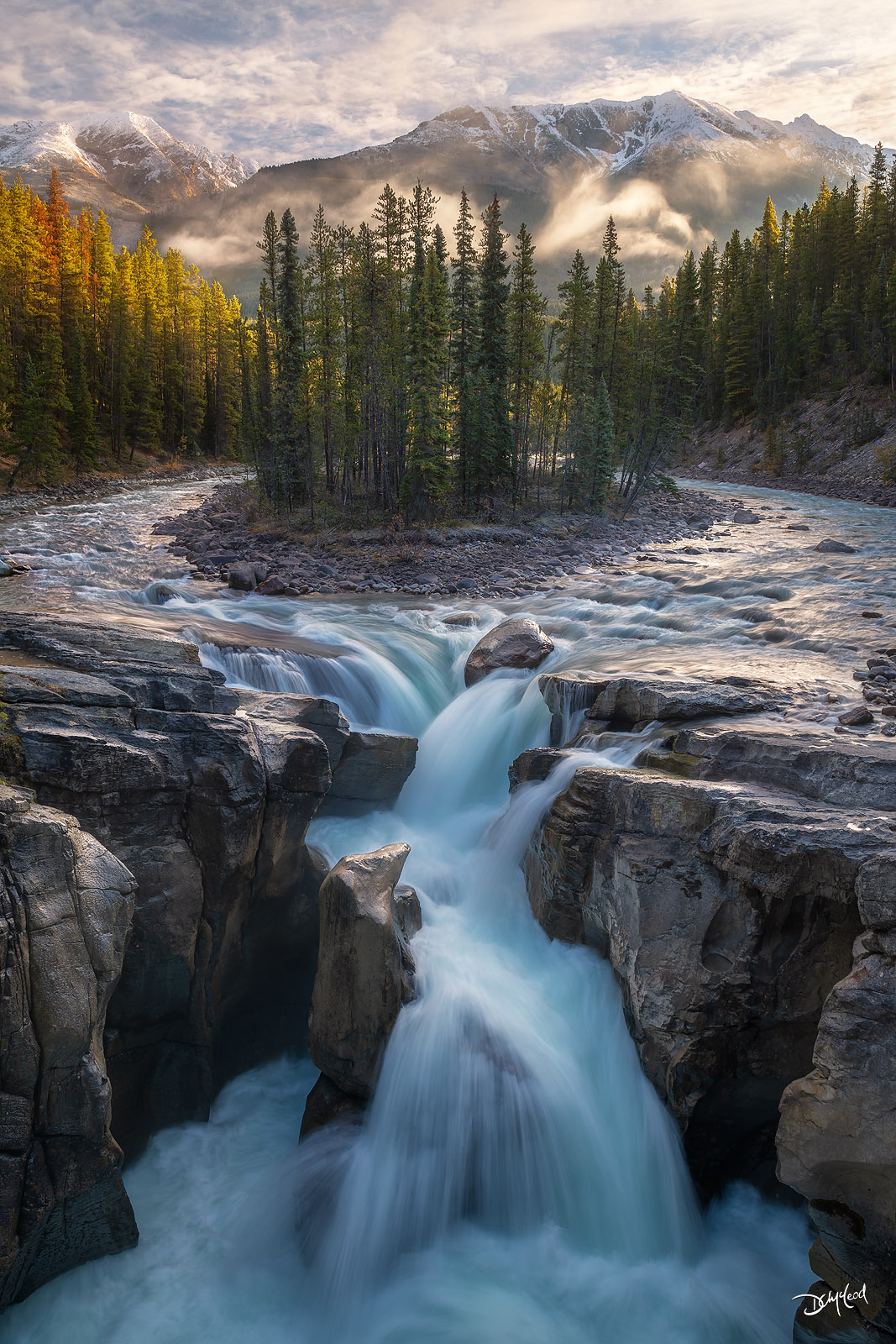
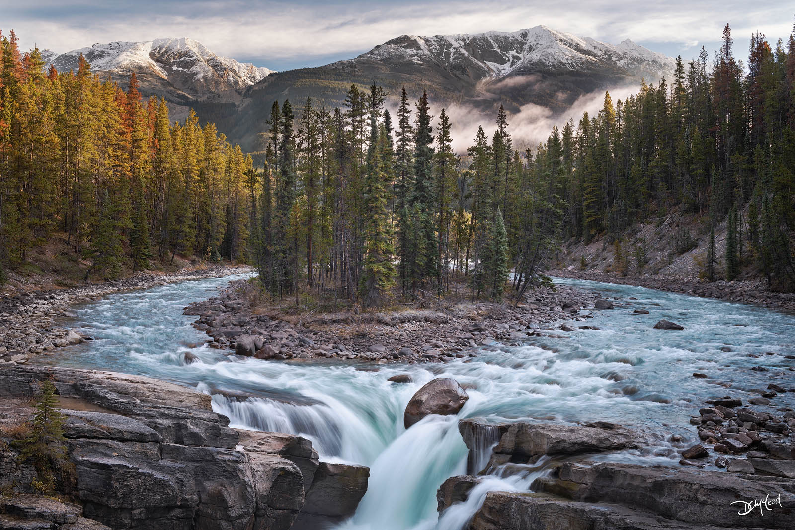
6. Mistaya Canyon
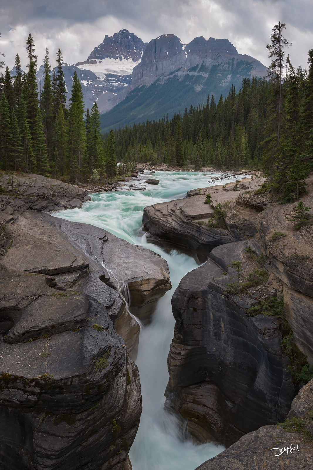
Distance: 74 kms from Lake Louise | 158 kms from Jasper | 5 kms from SK Crossing
Best Light: Midday (soft overcast or partial sun ideal)
Best Time of Year: July to September
Roadside parking lot with bathrooms. Go to the north end of the lot where a gradual 5-10 minute descent down a trail leads to the powerful Mistaya River carving through a limestone canyon.
Caution should be taken walking on the rocks near the edge which can be slippery when wet. Perfect for long exposures and abstract compositions.
7. Saskatchewan River Crossing | Howse Pass Viewpoint
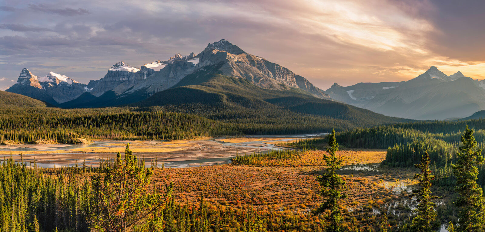
Distance: 79 kms from Lake Louise | 153 kms from Jasper
Best Light: Sunrise or sunset
Best Time of Year: July to October. Fall colour mid September to early October
A vast open valley where rivers converge beneath expansive skies. Often overlooked, but exceptional for wide panoramic frames. Pull into the Howse Pass Viewpoint parking lot/picnic area, just before the Highway 11 intersection for this view looking south at sunset.
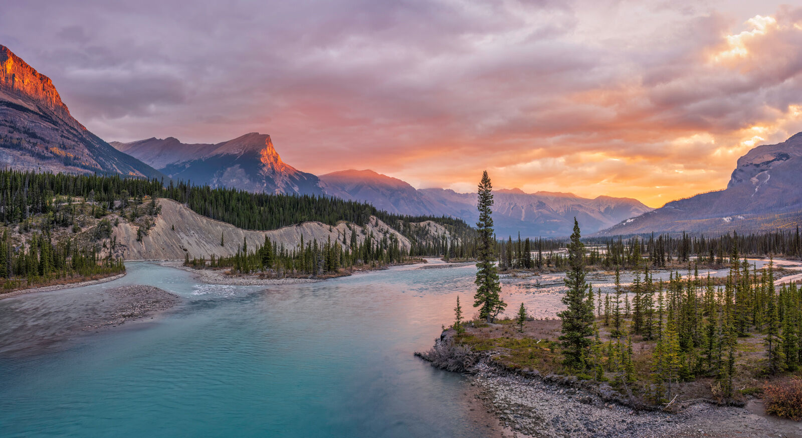
For a shot looking northward in the morning, find somewhere safe to park on either side of the bridge, then go safely on foot for a great vantage point right over the river. Be very careful and mindful of the traffic here. Safety first.
Basic services such as gasoline, a general store, restaurant, and lodging are available, but are only open from late May to October. Gas is expensive here so it is recommended to fill up in Lake Louise or Jasper instead.
Optional Highway 11 Side Trip
Saskatchewan Crossing is also the junction with the David Thompson Highway 11 northeast, if you wish to take a reasonably short side trip from the Icefields Parkway and visit Abraham Lake and/or Crescent Falls, depending on the season.
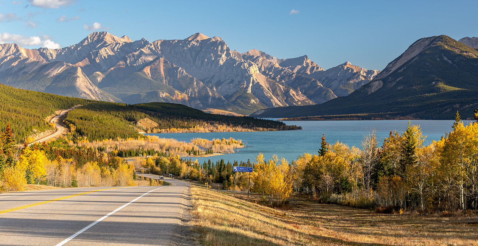
Abraham Lake is actually a man-made reservoir with a hydro-electric dam. For a short window of time each autumn, the lake level rises enough that some aspen trees growing near the shoreline become partially submerged for a unique photo opportunity (see location #9).
8. Mount Wilson Pond
Distance from Saskatchewan Crossing: 0.7 kms
Best Light: Sunrise
Best Time of Year: Mid September to early October
Just a short 0.7 kms after you turn onto Highway 11, watch for a small turn-off on the left (north) side of the road. Drive in just past the trees and park. There is a pond hidden from the highway that is perfect for reflections of the mighty peaks of Mount Wilson above. Come here at sunrise in autumn for a shot like this.
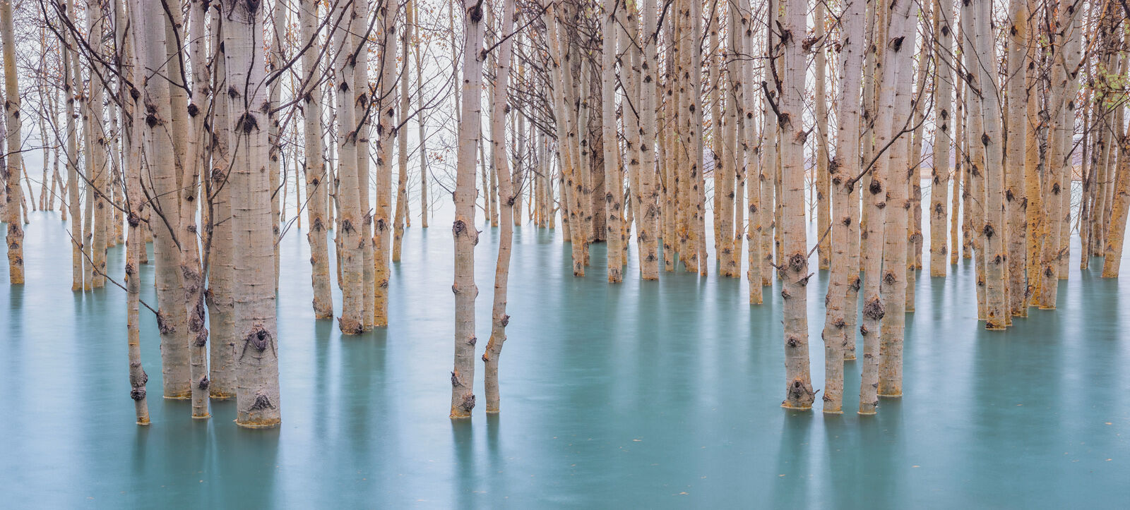
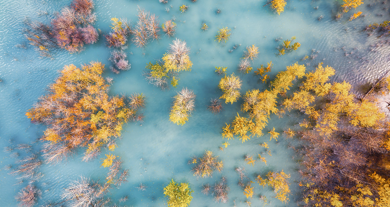
9. Abraham Lake Sunken Aspens (Autumn Only)
Distance from Saskatchewan Crossing: 31 kms
Best Light: Sunrise or overcast
Only Time of Year: Mid September to early October
Although there are many treed areas along the western shores, the Preacher's Point South camping area is one of the best locations to see the sunken aspens if your timing is right. For more compositional opportunities, bring hip waders and wander into the shallow water with your tripod. Dark ND filters are a must for smoothing the rippling water with long exposures.
This is also one of the very few places near the Parkway that you can fly a drone legally, as it is not in a national or provincial park. Be mindful as it can be windy here.
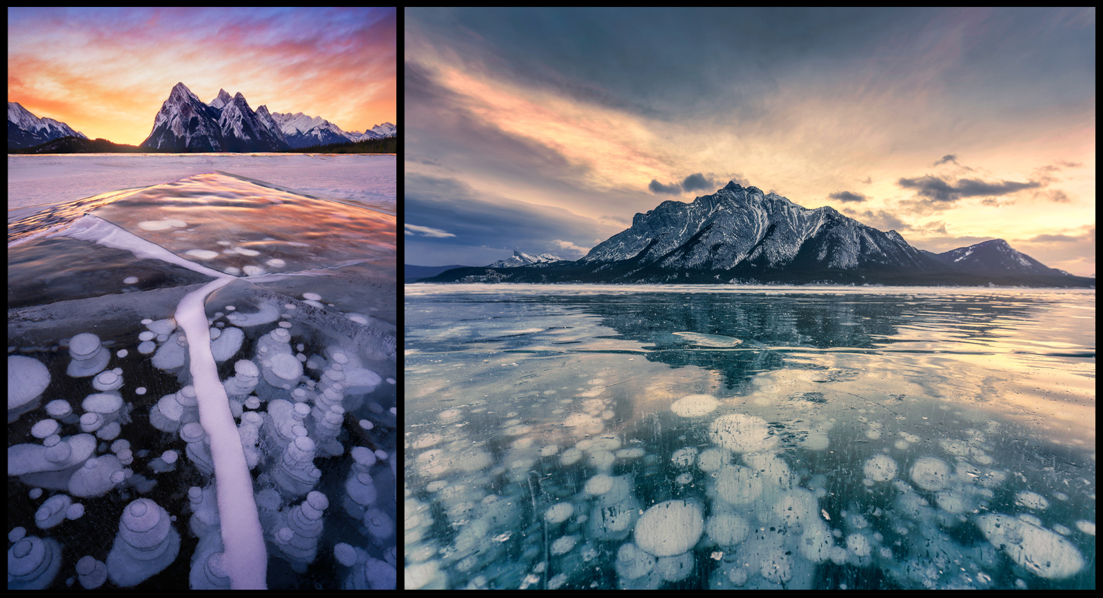
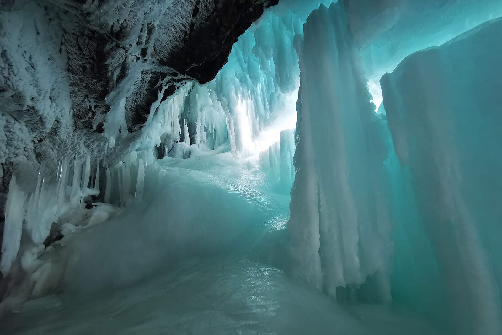
10. Abraham Lake Ice Bubbles
Distance from Saskatchewan Crossing: 31 kms to Preacher's Point; 52 kms to Ice Bubbles Viewpoint
Best Light: Sunrise
Best Time of Year: Mid January to mid February
With the ice bubble craze in full swing, Abraham Lake is quite reliable as the heavy winds will often keep large patches of ice reasonably clear of snow. Bring ice cleats for your boots, dress warmly, and be prepared for wind.
Above, left; Preacher's Point area looking south with the beautiful Normandy, Ardennes, and Rhine Peaks as a gorgeous backdrop. Above, right; The Ice Bubbles Viewpoint (just before Windy Point) looking south, backed by Mount Michener. If it's not overcast, be here at sunrise for the best lighting conditions.
11. Crescent Falls
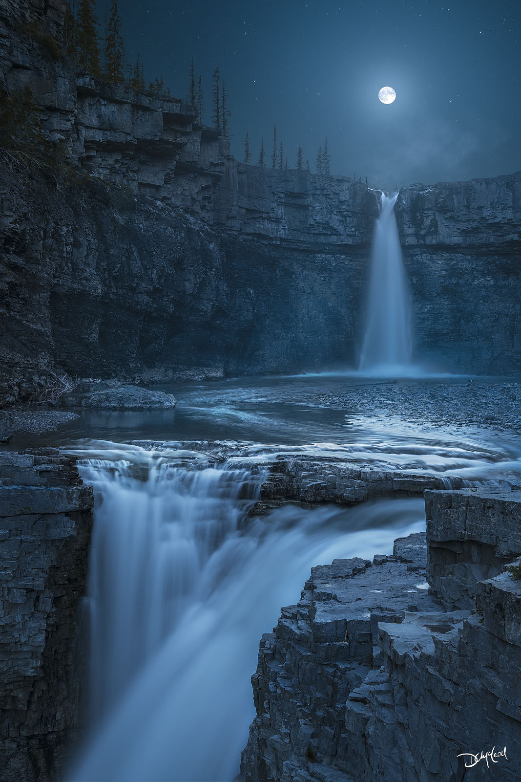
Distance from Saskatchewan Crossing: 78 kms
Best Light: Sunrise or sunset
Best Time of Year: June to September. June or July for highest water flow
Crescent Falls is a spectacular double waterfall on the Bighorn River, not too far past Abraham Lake. The turnoff is on the left (north side) of the highway, 72 kms from Saskatchewan Crossing. Follow the grid road west for another 6 kms to the parking lot.
There have been a number of recent upgrades to the area, including viewing platforms for the falls. There is also a hiking trail, day-use area, and a small campground.
For a more comprehensive overview of the falls, please read my Crescent Falls visitors guide.
Back to the Icefields Parkway
After your side trip to Abraham Lake or Crescent Falls, return to Saskatchewan Crossing to continue your journey along the Icefields Parkway, where countless photo opportunities await between Lake Louise and Jasper.
12. Weeping Wall
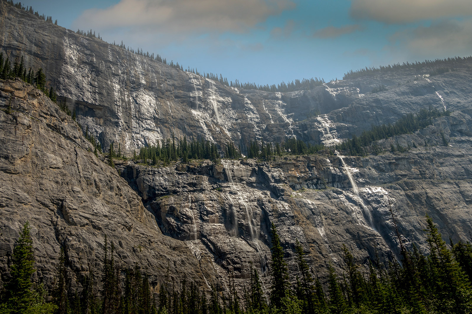
Distance: 108 kms from Lake Louise | 124 kms from Jasper | 29 kms from SK Crossing
Best Light: Morning or midday; spring & early summer
Best Time of Year: June or July for best water flow
Seasonal waterfalls cascade directly down the sheer cliffs at the base of Cirrus Mountain. Best photographed during peak snowmelt. Park in the pull-out on the left (west) side of the highway.
13. Big Bend Viewpoint
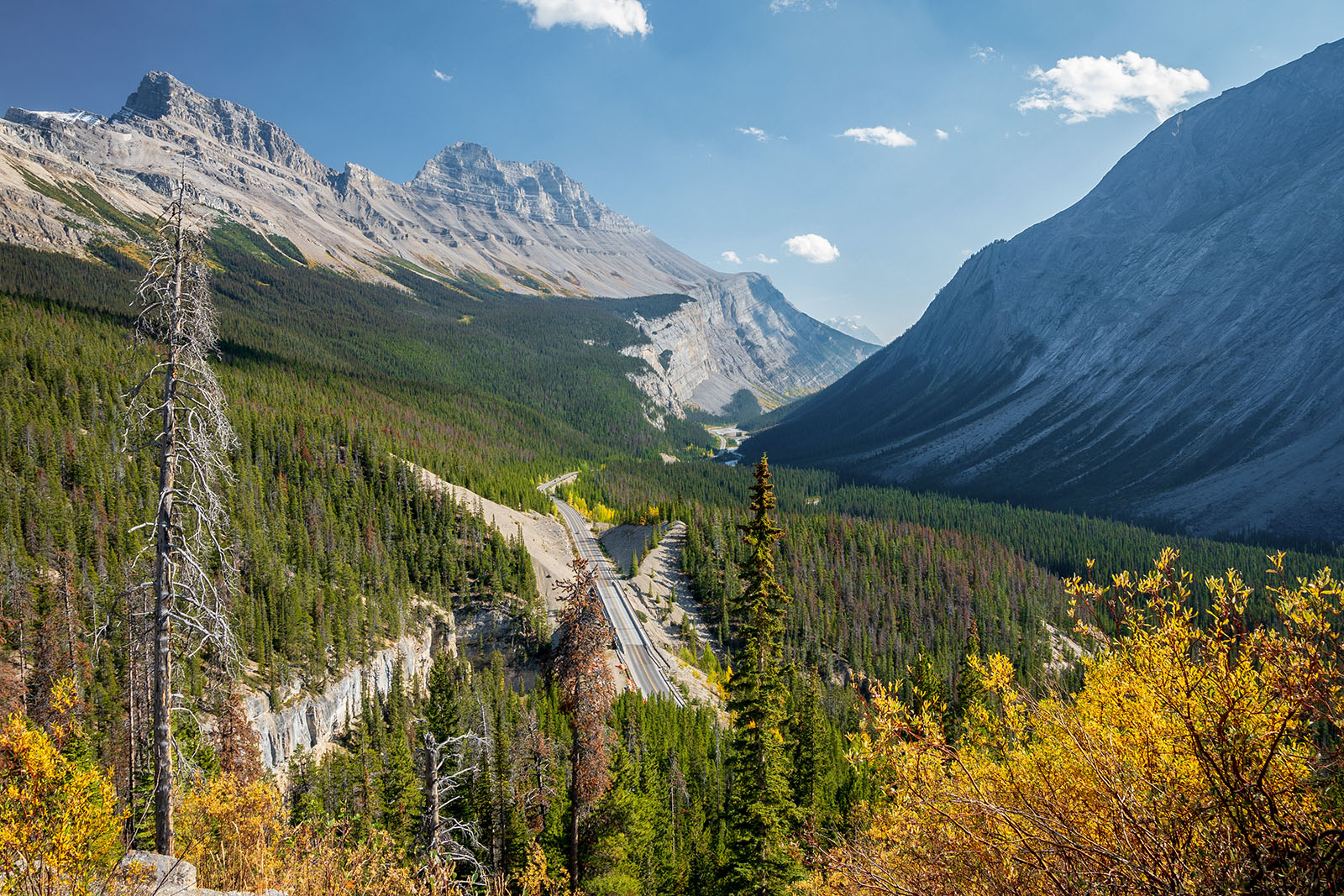
Distance: 115 kms from Lake Louise | 117 kms from Jasper | 36 kms from SK Crossing
Best Light: Morning
Best Time of Year: June to September. Fall colour in September
A pull-off at the top of a dramatic elevation-gaining S-curve in the parkway. Sweeping views of Mount Cirrus to the south down the valley — strong leading lines and scale.
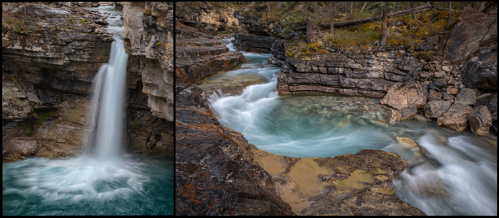
14. Panther Falls
Distance: 115.3 kms from Lake Louise | 116.7 kms from Jasper | 36.3 kms from SK Crossing
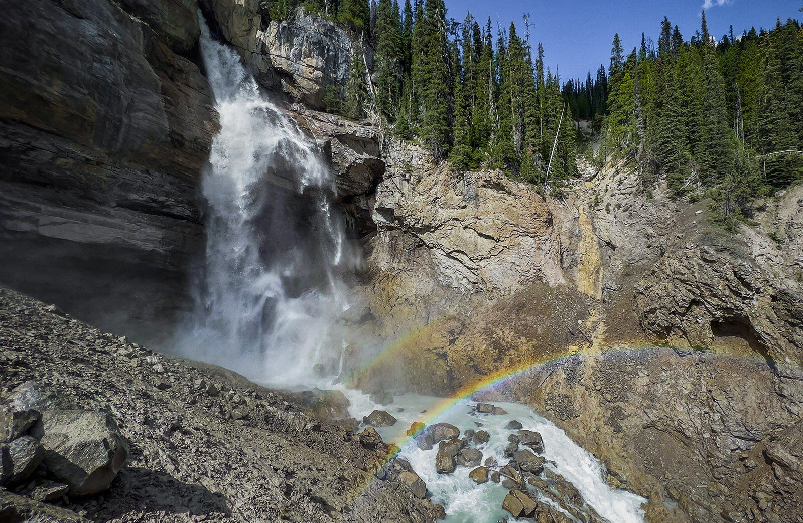
Best Light: Sunrise. Midday for possible rainbows during sunny conditions
Best Time of Year: June or July for highest water flow. January or February for unique ice photos
A quick roadside waterfall with layered rock textures. In the winter months of January or February, the falls are mostly frozen for some unique photo opportunities. Be sure to bring ice crampons for safety.
15. Parker Ridge Hike | Saskatchewan Glacier Viewpoint
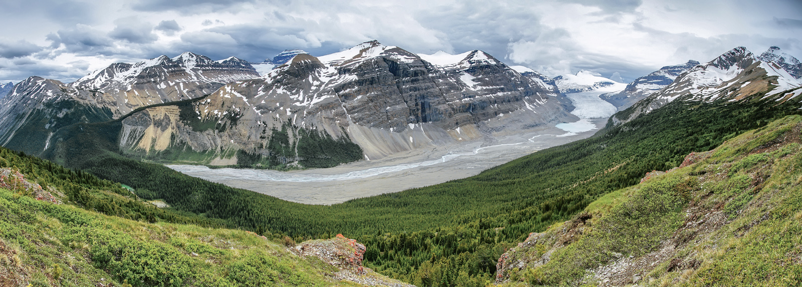
Distance: 120 kms from Lake Louise | 112 kms from Jasper | 41 kms from SK Crossing
Best Light: Sunny mornings
Best Time of Year: July to September
An ideal viewpoint for showing scale and glacial flow. From the parking lot on the left (south) side of the highway, a gradual 2.5 km hike to the top of Parker Ridge delivers expansive views of the Saskatchewan Glacier. Expect 2-4 hours round trip depending on fitness level and photo time.
The well-maintained trail is not technical and easy to follow. Pack warm clothing and a windbreaker for the ridge on cool days. Expect some lingering snow and muddy conditions on the trail if you go earlier in June.
Bring a telephoto for close up shots of the Saskatchewan Glacier, and on the way up or down the trail, views of Mount Athabasca and Hilda Peak are spectacular.
16. Sunwapta Pass
Distance: 124 kms from Lake Louise | 108 kms from Jasper | 45 kms from SK Crossing
Best Light: Sunrise or sunset
Best Time of Year: July to early October. Choose mid September to early October for fall colour.
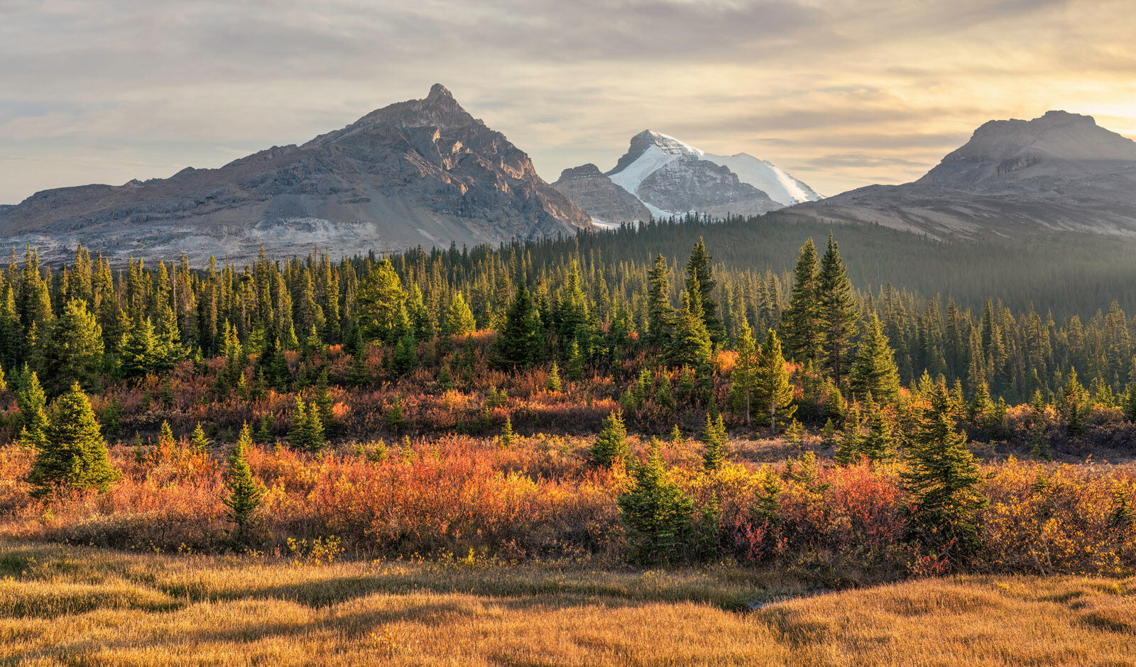
Sunwapta Pass is the second highest pass on the Icefields Parkway (after Bow Summit), and marks the boundary between Banff and Jasper National Parks. Perfect for a valley panorama of fall colour with a mountain backdrop, left to right; Hilda Peak, Mount Athabasca, and Boundary Peak.
Park in the pull-out on the south side of the highway. For a photo like this one, walk down into the valley bottom at sunset in autumn for soft light, long shadows, and colour galore.
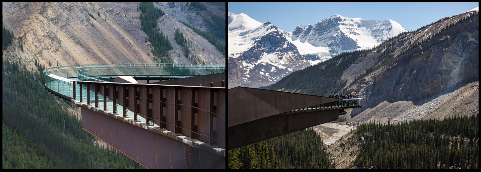
17. Columbia Icefield | Discovery Centre | Skywalk
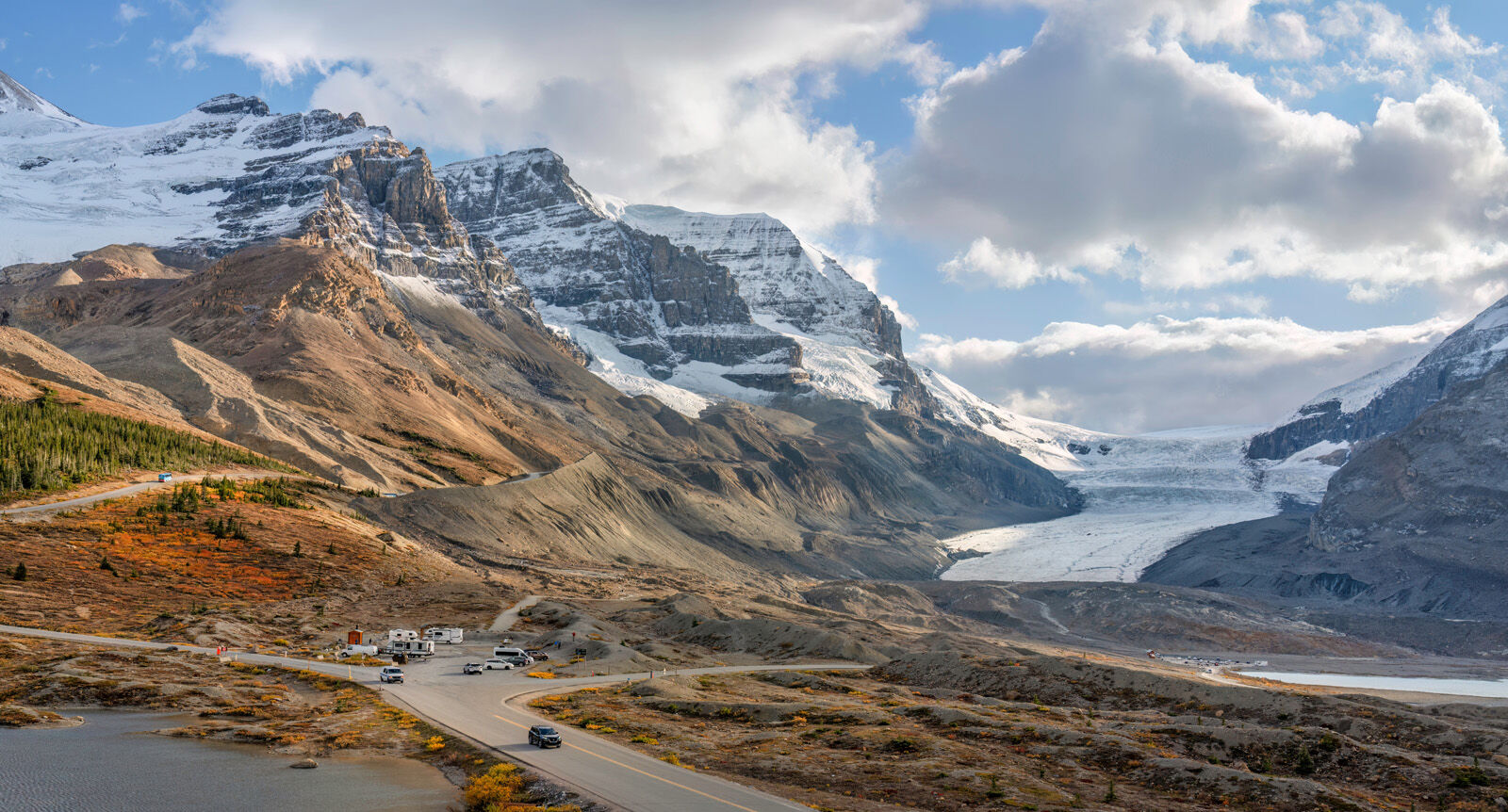
Distance: 129 kms from Lake Louise | 103 kms from Jasper | 50 kms from SK Crossing
Best Light: Early morning or late afternoon
Best Time of Year: July to September
An immense field of ancient ice feeding multiple glaciers. A powerful subject for wide panoramas and minimalist ice compositions; mid to telephoto lenses are useful here. The main area at the base of Athabasca Glacier area can be explored on foot from a small parking lot on the south side of the highway. Walk the area for numerous vantage points.
For a more immersive experience, visit the large Columbia Discovery Centre on the north side of the highway. They offer dining, a gift shop, lodging, and a wide array of tours in all-terrain ice explorer vehicles that can take you onto the glacier where you'll get out to walk on the ice.
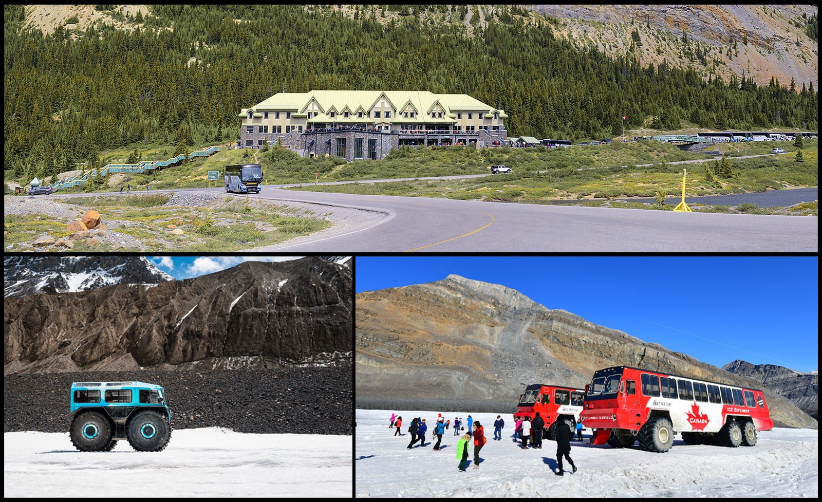
The Skywalk is a glass-bottomed walkway suspended almost 1,000 feet above the valley floor, located a short distance north of the Discovery Centre. Great for thrill seekers and families. No parking; accessible only by shuttle and tickets purchased from the Centre. Book ahead to guarantee tickets for the various tours and experiences.
18. Tangle Creek Falls
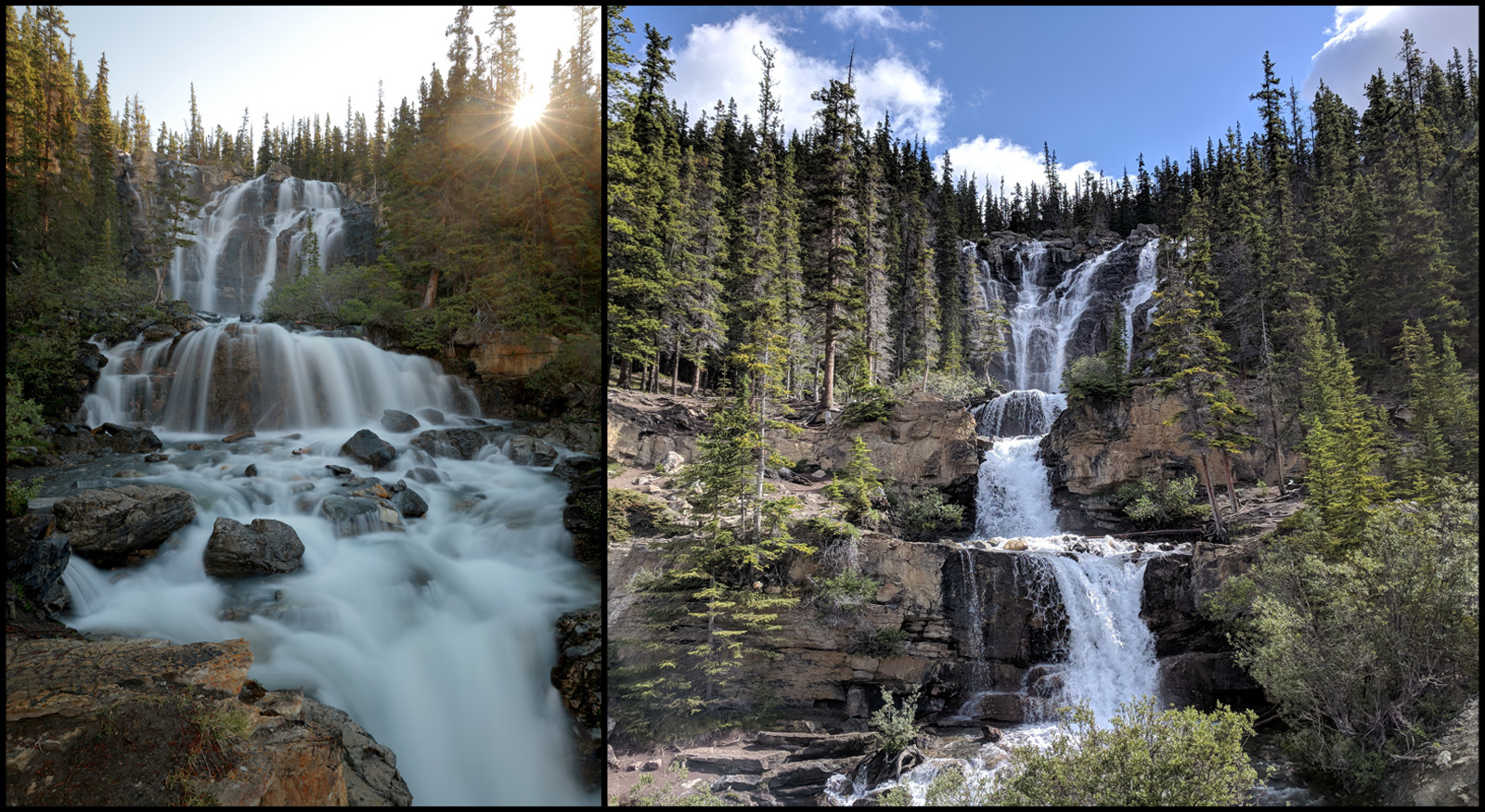
Distance: 136 kms from Lake Louise | 96 kms from Jasper | 57 kms from SK Crossing
Best Light: Morning
Best Time of Year: June to September. June or July for maximum flow
Multiple cascading tiers right beside the highway. Park in the pull-off on the left (south), check for traffic, and cross the road carefully. Wear rubber boots or waders for better shots. Explore the area from endless vantage points, experimenting with composition, shutter speed, and movement. Best water flow during spring runoff or after heavy rains.
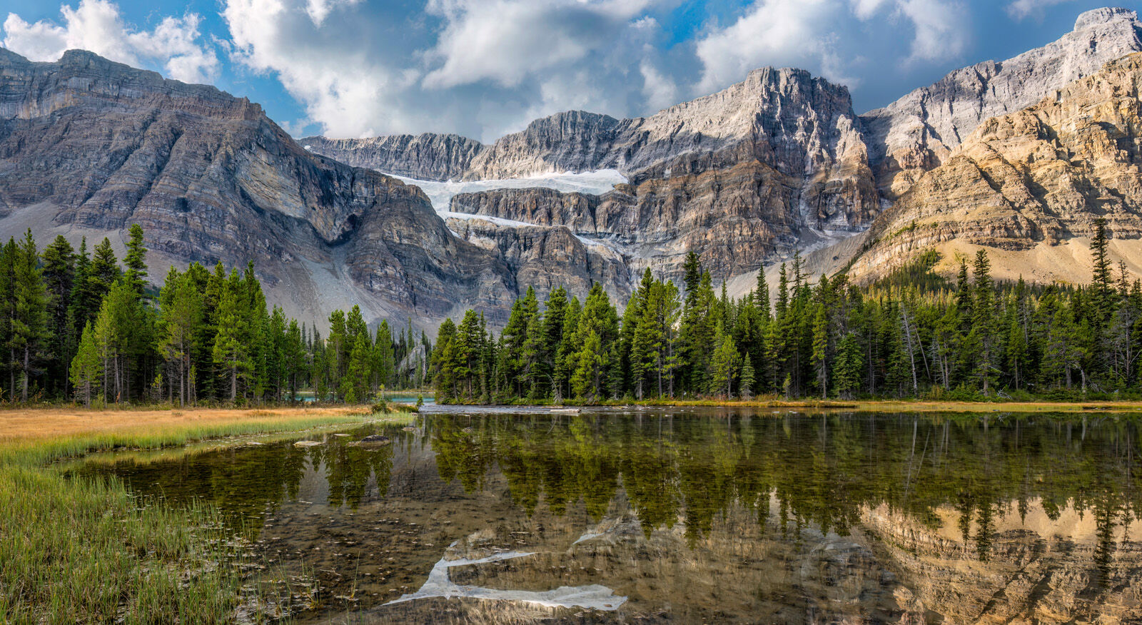
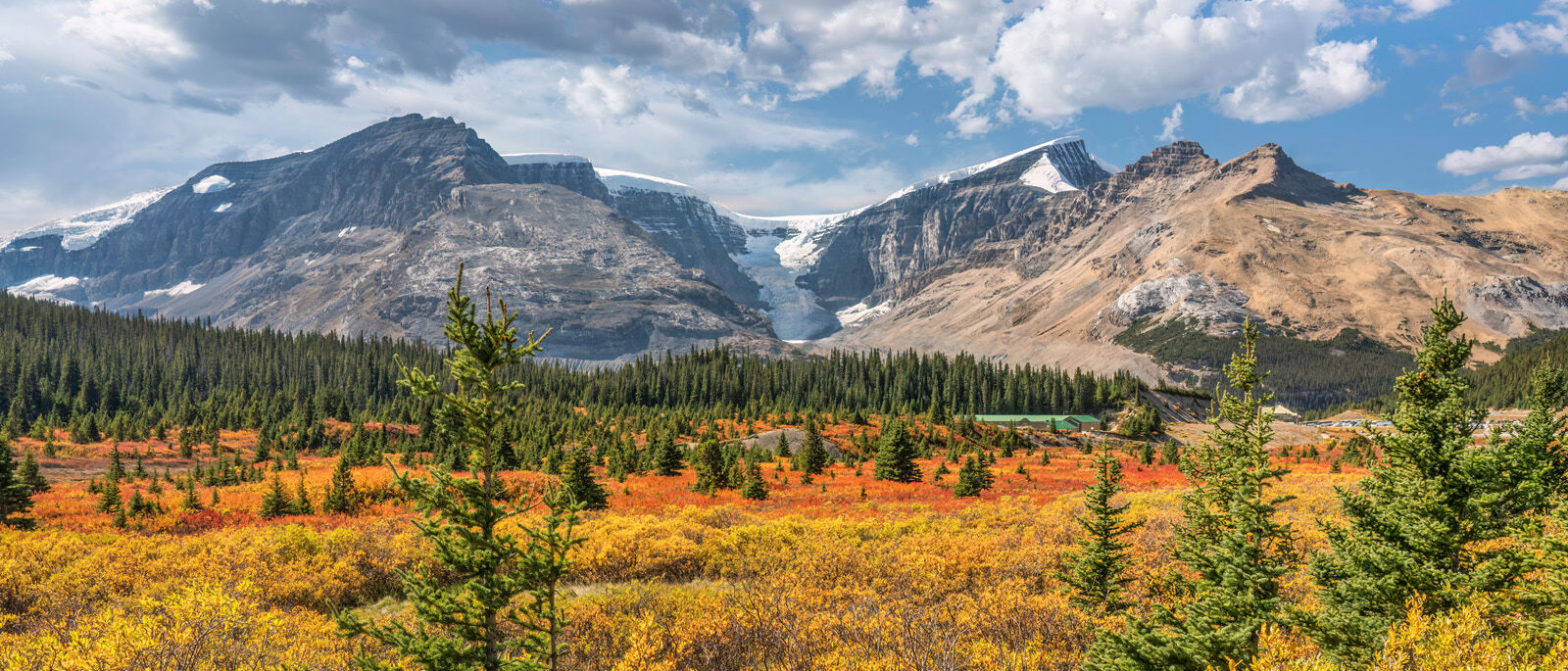
19. Stutfield Glacier Viewpoint

Distance: 137 kms from Lake Louise | 95 kms from Jasper | 58 kms from SK Crossing
Best Light: Afternoon
Best Time of Year: June to September
An underappreciated stop with strong mountain layering and glacier detail. Use your telephoto for close views of the glacier.
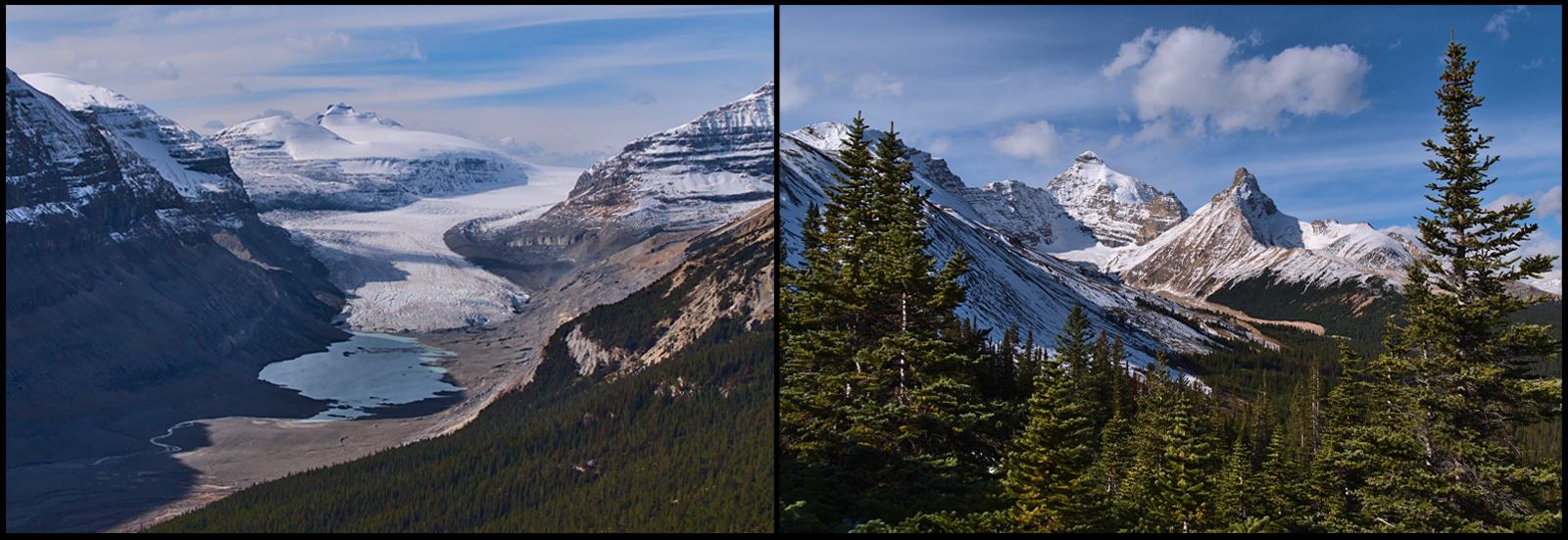
20. Sunwapta River Valley | Tangle Ridge
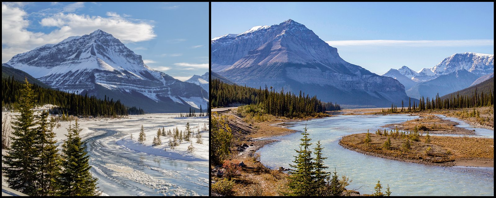
Distance: 144 kms from Lake Louise | 88 kms from Jasper | 65 kms from SK Crossing
Best Light: Sunrise
Best Time of Year: Late September; January to April for winter scenes
These photos taken from the same spot; one in autumn, the other in deep winter. The water level drops very low in January to early April, with mounds of snow, hoar frost-covered bushes, ice formations, and misty atmosphere. Small pools of shallow, open water make for perfect reflections.
Park at the Beauty Creek pull-out on the east side of the highway, carefully cross the road and wander up and down the river area looking for shots. Use Tangle Ridge mountain as a backdrop at sunrise. Wide angle lenses are perfect for closeup compositions.
Insulated waders, snowshoes and very warm winter clothing recommended. Safety first; be especially mindful of thin ice and watch where you step. Use a hiking pole to test water depth.
21. Beauty Creek | Stanley Falls
Distance: 144 kms from Lake Louise | 88 kms from Jasper | 65 kms from SK Crossing
Best Light: Morning or afternoon
Best Time of Year: June to September
This short but beautiful hike (3.2 km round trip) is often overlooked, so it is usually quiet. Park in the small pull-out on the east side of the Parkway, where Beauty Creek flows underneath the road through two large metal culverts.
Follow the path south along the creek, then through the trees to the 'old road' (this is the original Parkway from yesteryear). Continue straight south for 0.6 kms until you meet the creek, turn left, and follow the path up into the forest on the left side of the creek.
Elevation gain is minimal (40 metres) and there are numerous cascades and places to get close to the water for different compositions. Watch your kids and be very careful near the edges as you get higher up into the canyon.
22. Sunwapta Falls
Distance: 178 kms from Lake Louise | 54 kms from Jasper | 99 kms from SK Crossing
Best Light: Sunrise, morning
Best Time of Year: June to October. June or July for higher flow
One of the most famous waterfalls in the Canadian Rockies with a small island in the middle of the Sunwapta River, framed by forest and a mountain backdrop. Excellent for long exposures and dramatic compositions.
Turn off at the Sunwapta Falls Resort onto the short access road to the parking area. Picnic area and pit toilets available. The resort on the corner of the highway entrance features a restaurant, gift shop, and lodging.
For a more comprehensive overview of these falls, please read my Sunwapta Falls visitor's guide.
23. Goats & Glaciers Lookout
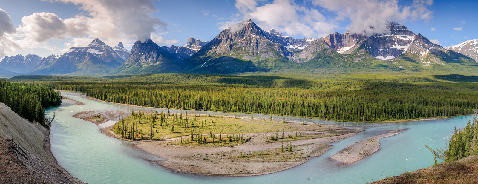
Distance: 194 kms from Lake Louise | 38 kms from Jasper | 115 kms from SK Crossing
Best Light: Morning
Best Time of Year: July to October. Late September for fall colour
Panoramic views of the turquoise Athabasca River with occasional sightings of the resident mountain goats. Mount Christie (far left) and the three Fryatt peaks make for a majestic mountain panorama. A great storytelling landscape.
24. Athabasca Falls
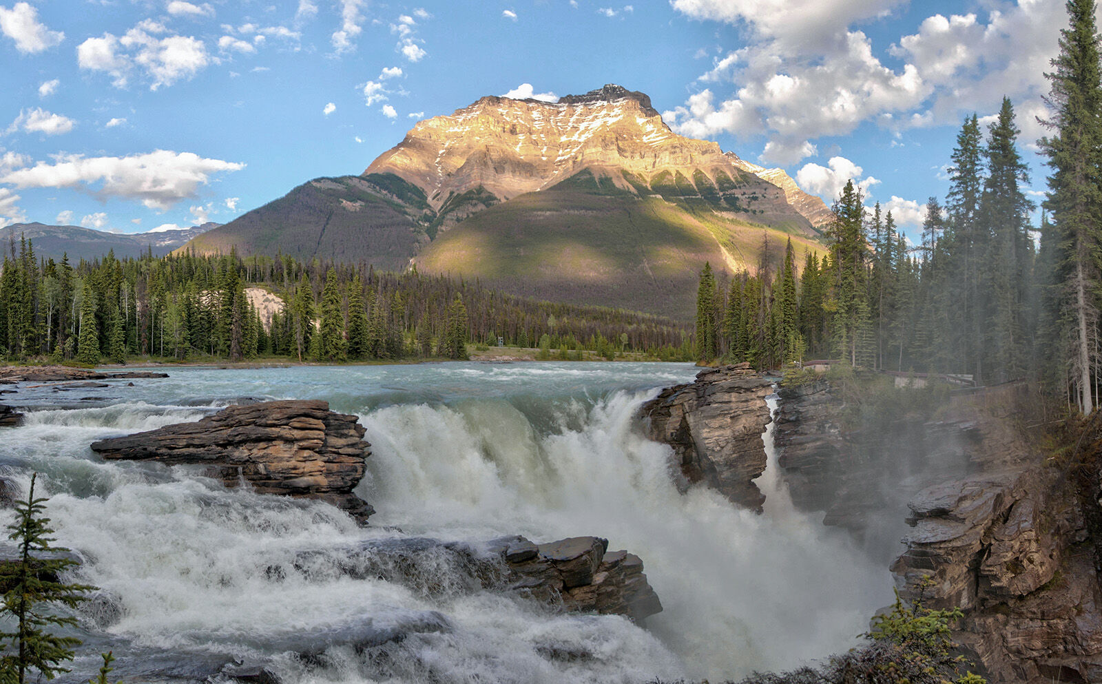
Distance: 201 kms from Lake Louise | 31 kms from Jasper | 122 kms from SK Crossing
Best Light: Early morning, late afternoon, sunset
Best Time of Year: June to September. June and July for maximum flow.
A forceful waterfall in the springtime; strong compositions from multiple viewpoints beneath Mount Kerkeslin. The appearance of the falls varies dramatically depending on water flow. June and early July display the highest flows, however, all of that water tends to obscure the fascinating rock structures.
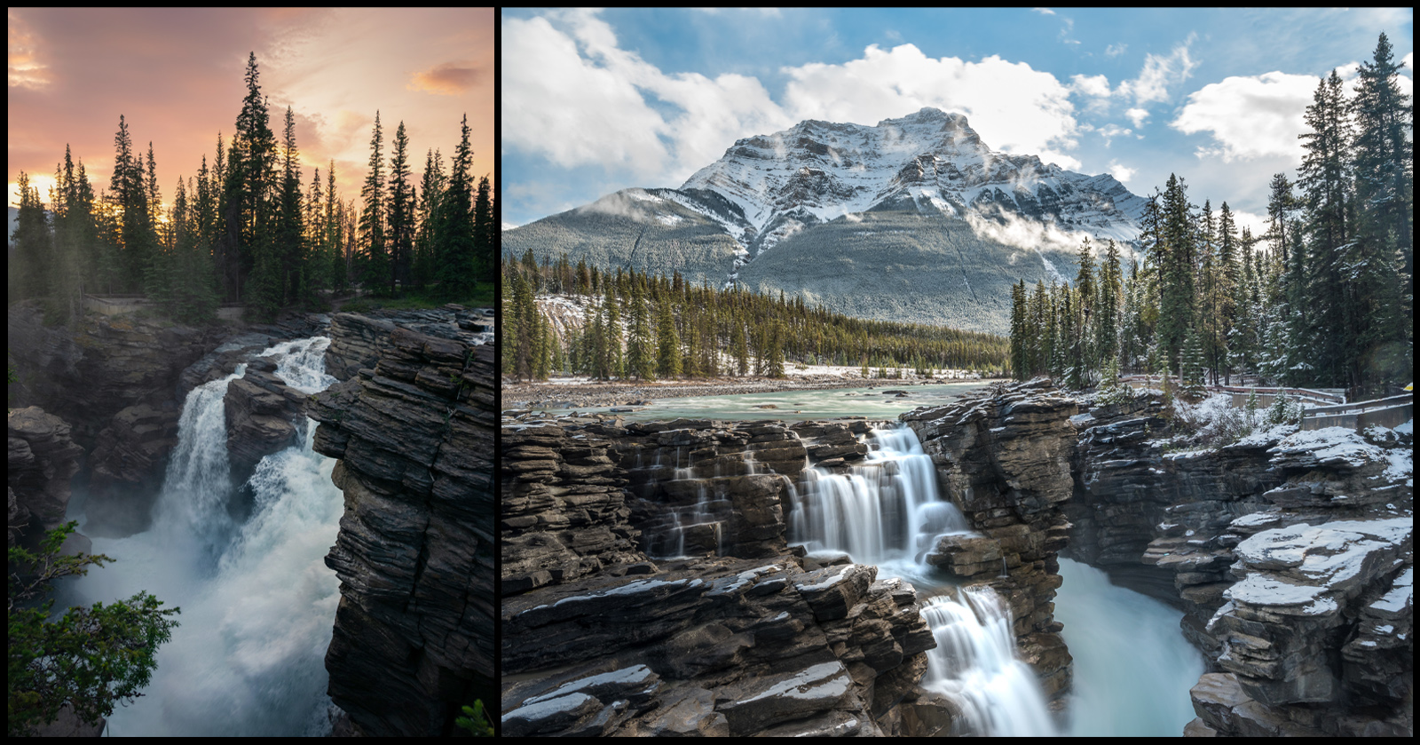
Try visiting in late July to early September for lesser flow and more texture from the rocks, depending on the shot you want to capture. Take advantage of multiple viewpoints and fresh perspectives.
25. Pyramid Lake (Jasper Area)
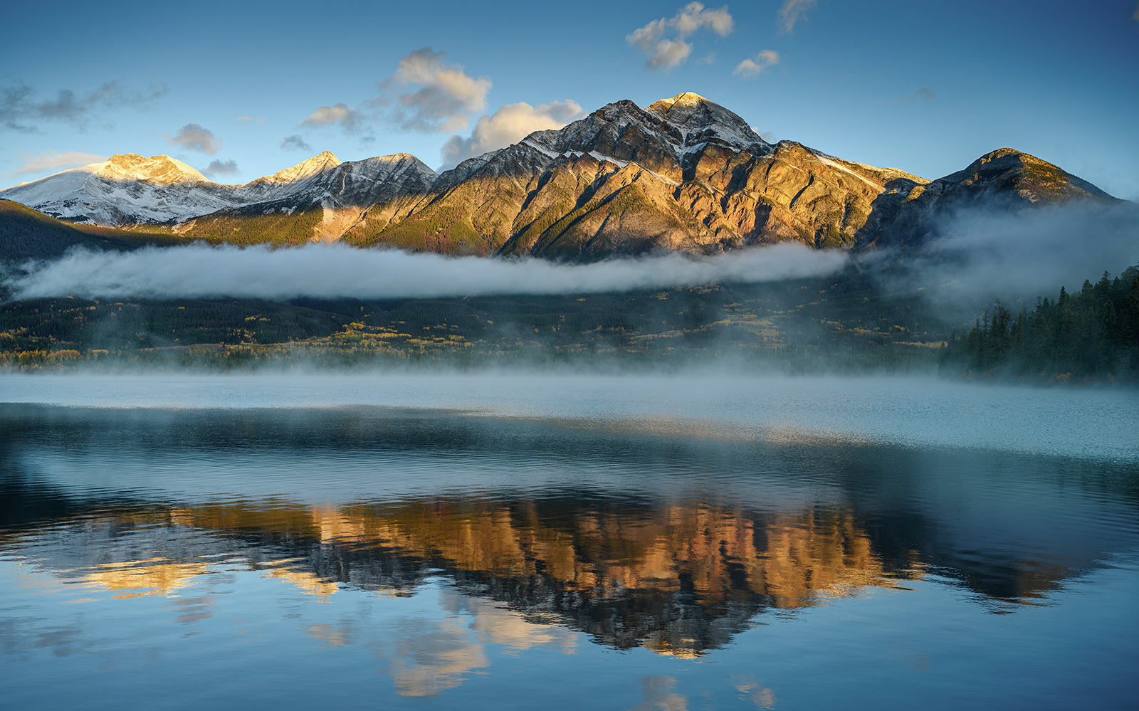
Distance: 237 kms from Lake Louise | 4 kms northwest from Jasper | 158 kms from SK Crossing
Best Light: Sunrise
Best Time of Year: July to October; fall colour in September/October
Follow the Pyramid Lake Road to this serene alpine lake just outside Jasper, perfect for reflections and sunrise/twilight scenes — an ideal finale to the journey.
Photography Tips for the Icefields Parkway
Best Seasons
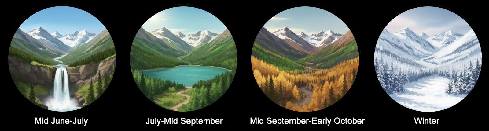
- Mid June–July: Peak flow waterfalls, lingering snow in June
- July-Mid September: Summer beauty, more crowds
- Mid September-early October: Autumn colour, fewer crowds. Mostly coniferous trees with majority of aspens in southern portion. Look for colourful grasses and bushes.
- Winter: Various atmospheric and frosty scenes. Challenging conditions.
Gear Recommendations
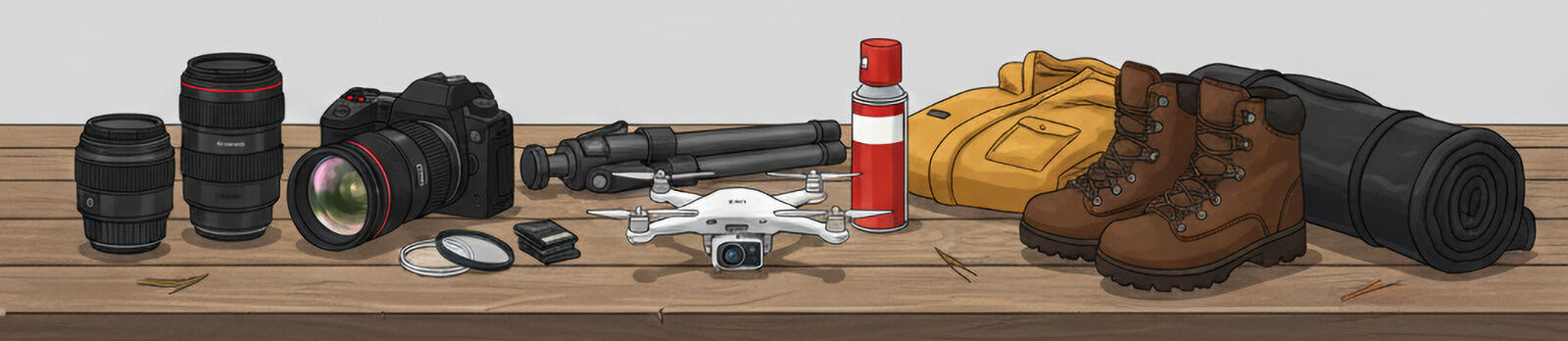
- Wide-angle (14–24mm) for close-up or expansive scenes
- Mid-range (24-70mm) most popular, great for panoramas
- Telephoto (70–200mm) for mountain portraits and isolating glaciers
- Tripod, lots of batteries, car charger, memory cards, lens cloths
- ND filters for smoothing water or skies; polarizer for lakes and ponds
- Of the locations in this guide, drones are legal in Abraham Lake area only. Follow the laws and be mindful of heavy winds. Always check current Transport Canada regulations and local restrictions before flying
- Hip waders for more opportunities around lakes, rivers, and waterfalls
- Warm clothing, pocket warmers, and waterproof footwear/hiking boots
- Bear spray (This is bear country. Safety should always be a priority)
Conclusion
From the glassy calm of Herbert Lake to the roaring power of Athabasca Falls, each stop offers opportunities for extraordinary shots, making the Icefields Parkway a continuous gallery of world-class landscapes.
If you find this guide helpful, feel free to share it with fellow photographers or reference it in your own trip planning resources. A link back is always appreciated and helps support the creation of free guides like this one.
If you’re exploring the Canadian Rockies more broadly, check out my Moraine Lake guide and Three Sisters Canmore guide for additional iconic locations nearby.